RoboGEO
6.3.0
Size: 13.35 MB
Downloads: 6253
Platform: Win98,WinME,WinNT 3.x,WinNT 4.x,Windows2000,WinXP,Windows2003
To enjoy the functionality the RoboGEO application has to offer, you must first go through two simple steps that do not take long to complete. I am of course talking about downloading and installing the application on your Windows-powered computer.
The RoboGEO download weighs in at 10.7MB, which isn’t that much. On a high-speed internet connection, it will only take a moment to get RoboGEO off the web and onto your computer. If you are on a less than spectacular, take a hint and get a better connection. Waiting for downloads/uploads to complete is never fun; on a lousy internet connection you will always waste time waiting around for them to complete.
Installing RoboGEO is a piece of cake. Simply launch the executable you downloaded and follow the instructions presented by the setup wizard; you will be done before you know it. It must be mentioned here that RoboGEO provides support for several version of the Microsoft-developed Windows operating system. At the time of writing this and according to the developer, RoboGEO provides support for Windows NT, ME, XP, 2000, Vista, and Windows 7.
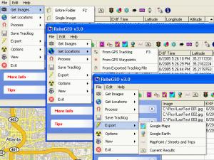
Once RoboGEO is up and running, it is finally time to enjoy the functionality it has to offer. Here is what you can expect to be able to do with RoboGEO:
- Add latitude, longitude, altitude and photo direction to the image's EXIF headers and thus permanently embed the location data within the actual image. Don’t worry, the image quality will not suffer if you do this.
- Add a watermark at the bottom of an image, watermark that contains the local time, UTC offset, latitude, longitude, altitude, photo direction and datum.
- Geocode photos using Google Earth
- Upload photos to Flickr
- Associate audio files with photos
- Export photos to Microsoft's MapPoint or Streets & Trips.
- Create Google Earth™ KML or KMZ files
- Create Google Map web pages with icons that show where each picture was taken
- Create ESRI Shapefiles that can be viewed in ArcView.
- Create DXF files that can be viewed in AutoCAD
- Create GPX files that can be used by various GPS utilities
Please note that RoboGEO is only free to try. The trial version, which is not time-limited, intentionally introduces inaccurate latitude and longitude values (inaccurate by about 1km).
Pros
- Easy to use
- Plain and intuitive interface
- Attach latitude, longitude, and altitude information to images
- Associate sound files with images
- Works with Windows 7
Cons
- Free to try (inaccurate latitude and longitude values)
RoboGEO
6.3.0
Download
RoboGEO Awards

RoboGEO Editor’s Review Rating
RoboGEO has been reviewed by George Norman on 18 Nov 2010. Based on the user interface, features and complexity, Findmysoft has rated RoboGEO 4 out of 5 stars, naming it Excellent


